Module 6 - Georeferencing - Connecting the Dots
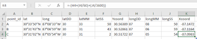
This week's lab was all about georeferencing and creating georeferenced data. The first part of this lab consisted of georeferencing the aerial photos of the UWF Campus to polygons shapefiles of the UWF buildings. I learned the importance of selecting the unknown layer first as, when I accidently inverted the process order, the photo raster started rotating and compressing in strange and unproductive ways. While the picture was never perfectly lined up to every corner of every building, I managed to get it close enough to be acceptable (RMS Error = ~<10 for both northern and southern aerial photos). After this I created two shapefiles (polygon of building 72 and line designating Campus Ln) using the georeferenced photos as a guide. Then we added The location of an Eagle's nest just off of Campus Drive and added a link to the photo to the attribute table of the nest data. I then added a protection barrier around the Eagles nest, designating an area of land that should not be disturbed (330 ft barrier) and an area that should not have any construction done to it (660 ft). All of this data was used to make a map layout, including the RMS data and an inset map showing the location of the Eagle's Nest in relation to Campus Dr. (pictured below).


Comments
Post a Comment